

A lake cruise of over 100 nautical miles departing from Lake Murten. Impossible? Well, as Murten, Neuchâtel and Biel are linked by a network of canals that stretches as far as Solothurn, it’s possible. Seen from the air, these three lakes with their diametrically opposed shapes also offer very different landscapes from the cockpit of a boat.
Morning meeting in Faoug
The charming little town of Faoug is practically perched on the border between the cantons of Vaud and Fribourg. On this warm June morning, we meet at the quayside of the Jack Beck marina, where I’m greeted by a magnificent 1970s motorboat. Dressed in varnished wood, it’s already donning its bimini to protect us from the powerful sun. The aim of this lake cruise is to discover many of the boating options the Three Lakes region by exploring the confines of Lakes Murten, Neuchâtel and Biel.
Flat calm on Lake Murten
With a length of 8 km and a width of around 2 km, Lake Murten may appear to be a playground for light sailing and towed sports. But when you look at the composition of the surrounding harbours, starting with the Jack Beck marina, the reality is quite different. The dimensions of the boats moored here are indeed much larger than we could have imagined, suggesting sailing possibilities far beyond the lake’s natural limit.
We’re on our way to the lake’s only gas station, at the port of Vallamand on the north shore. Aboard a 6.15 m Labhart (built on the Lake Constance side of the lake), skipper and owner Denis Perregaux-Dielf, who is also one of the directors of the Jack Beck shipyard, gives me the pleasure of discovering his beautiful region.
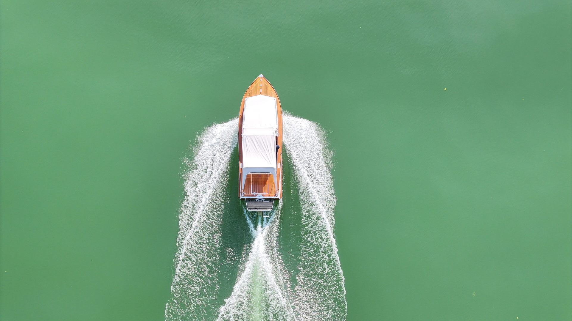
The charm of the old: barely out of the Jack Beck marina, the sound of the Volvo Penta 145 hp is very present on board, and its vibrations make the plywood hull echo, all the more so as the pace is fast: we want to circumnavigate the three lakes and be back in Faoug before sunset! And just in time, with the Fête de la Musique only a few days away, the days are long.
DOMINATES THE NORTH SHORE OF LAKE BIENNE. Louis Taurel
Before heading east to the Broye Canal, we pass the medieval town of Murten. It dominates the south-eastern shore of the lake. The roots of today’s town go back to the second half of the 11th century (it was built on the ruins of a Roman-era town sacked in the early 12th century by the Emperor of the Holy Roman Empire).
With the port at the foot of the town, it’s easy to visit after mooring your boat in one of the visitor squares. The picturesque arcades of the main street are home to a number of highly recommended restaurants. Nightlife is also very lively, thanks in no small part to the many festivals that take place here.
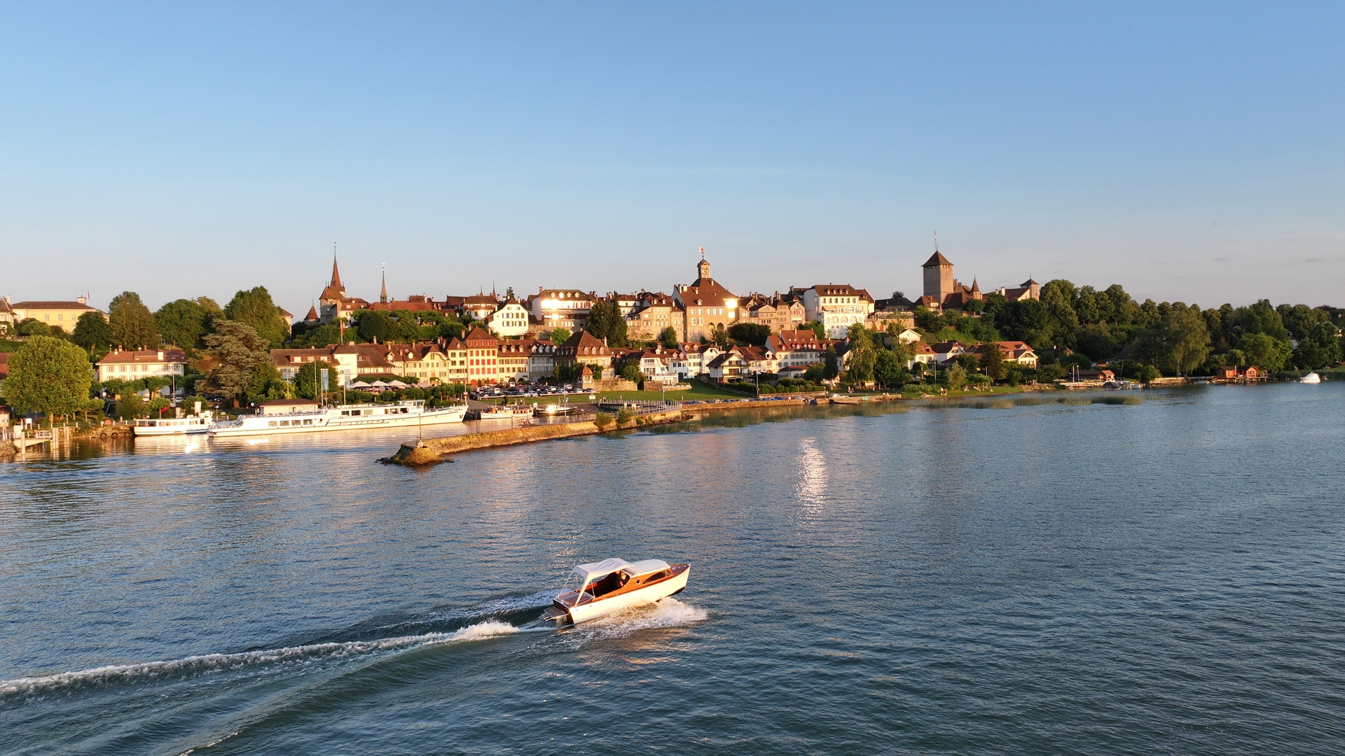
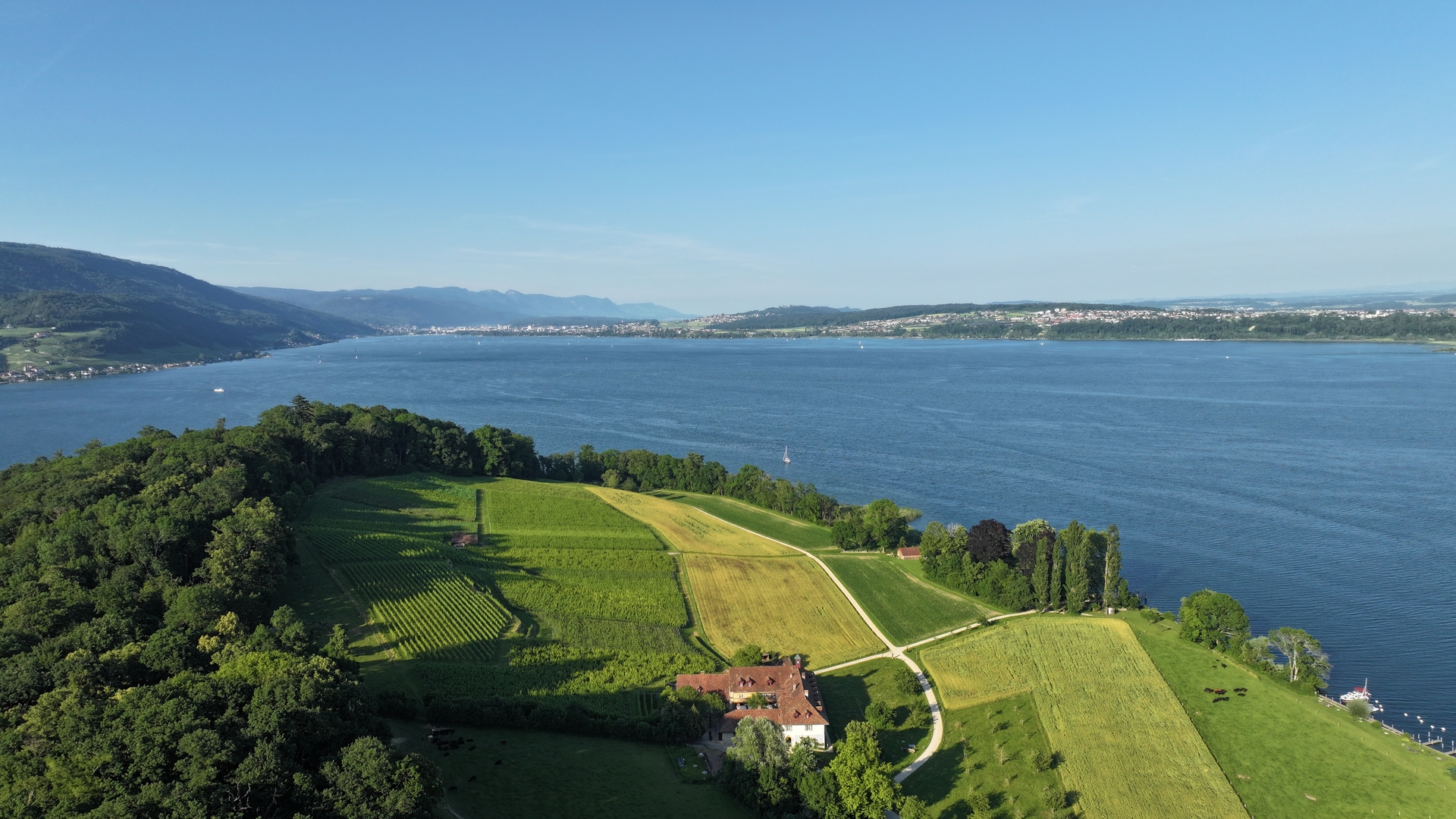
Opposite, the northern shore of Lac de Morat is more undulating, with beautiful hillside vineyards, notably those of Mont-Vully, which produces a white wine that is the pride of the region’s inhabitants.
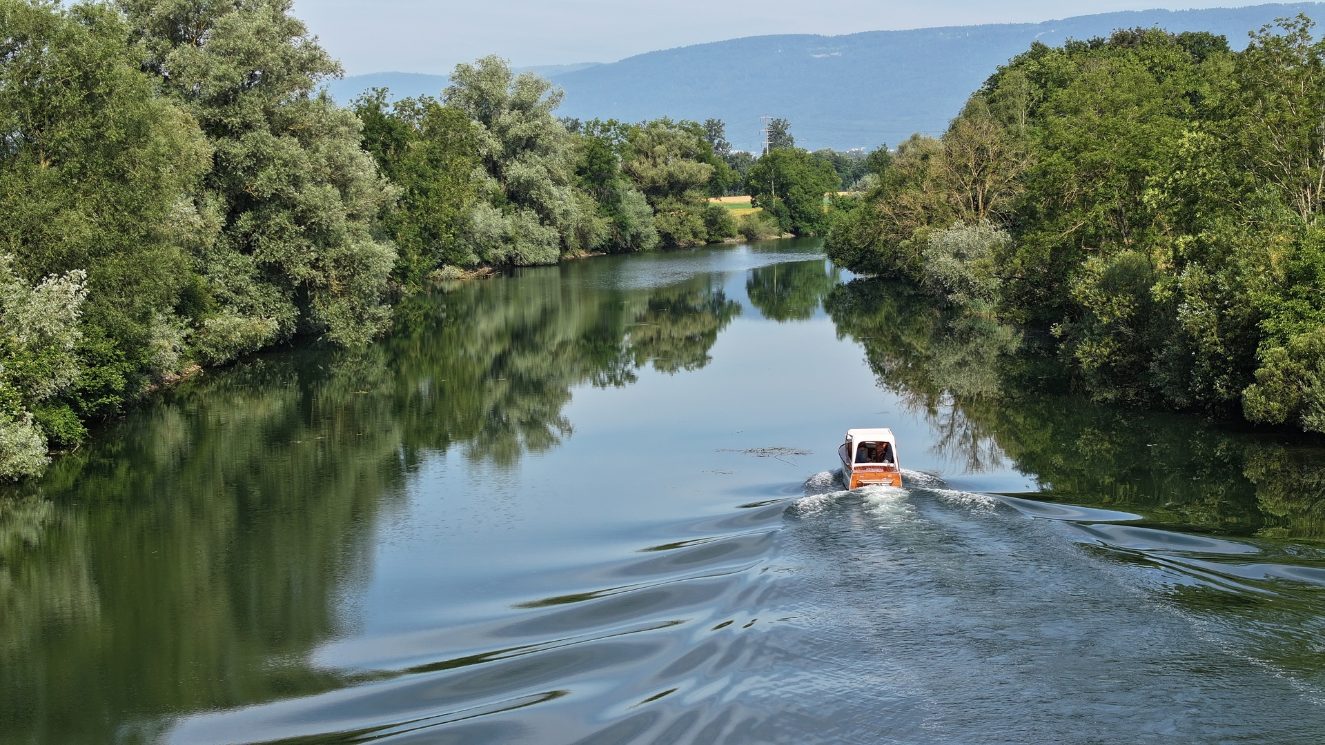
The mouth of the Broye Canal lies to the northeast of Lake Murten. The 8.4 km-long canal takes 30 minutes to reach Lake Neuchâtel at 15 km/h (8 knots). We cut the throttle. At this speed, we’re moving water, but the noise level is much lower.
Although the Broye has always linked Lac de Morat to Lac de Neuchâtel, its original course was very winding. The reclamation of the Orbe, Seeland and Broye plains carried out in the second half of the 19th century (first Jura water correction) not only made the surrounding land suitable for farming, but also straightened the natural course of this river (and the other canals in the region, which we’ll follow later). In the 1960s, the canal was widened to facilitate navigation. A godsend for the boating industry, which was beginning to flourish at the end of the 20th century!
As we progress, I notice that the first quarter of the canal is bordered by campsites and shipyards. As we make our way towards Neuchâtel (in the direction of the very gentle current, which oscillates between 0 and 1.6 knots), the landscape becomes increasingly rural, with a multitude of remarkable trees sheltering the canal and giving us the feeling of sailing in a veritable cocoon between forests and fields. On this Wednesday morning, traffic on the canal is very reasonable,
we pass only three boats! Denis confides that, as a child, going to Lake Neuchâtel from Lake Murten was a bit like going to the sea; seeing the expanse of water before us, I understand his point!
The “sea” of Neuchâtel
Once we’ve reached the end of the canal, we notice photographers on either side of us with impressive 800mm lenses. For a moment, I’m surprised by Denis’ fame, but he pulls me out of my reverie by explaining that we’re crossing the Grande Cariçaie, Switzerland’s largest nature reserve. It stretches over 40 km (3,000 hectares) on the southern shore of the lake, and is home to a quarter of Switzerland’s flora and fauna. In reality, these photographers are looking to catch a rare laughing frog or a Baillon’s Crake, an extremely rare bird that once disappeared from Switzerland but has recently re-established itself in this natural area.
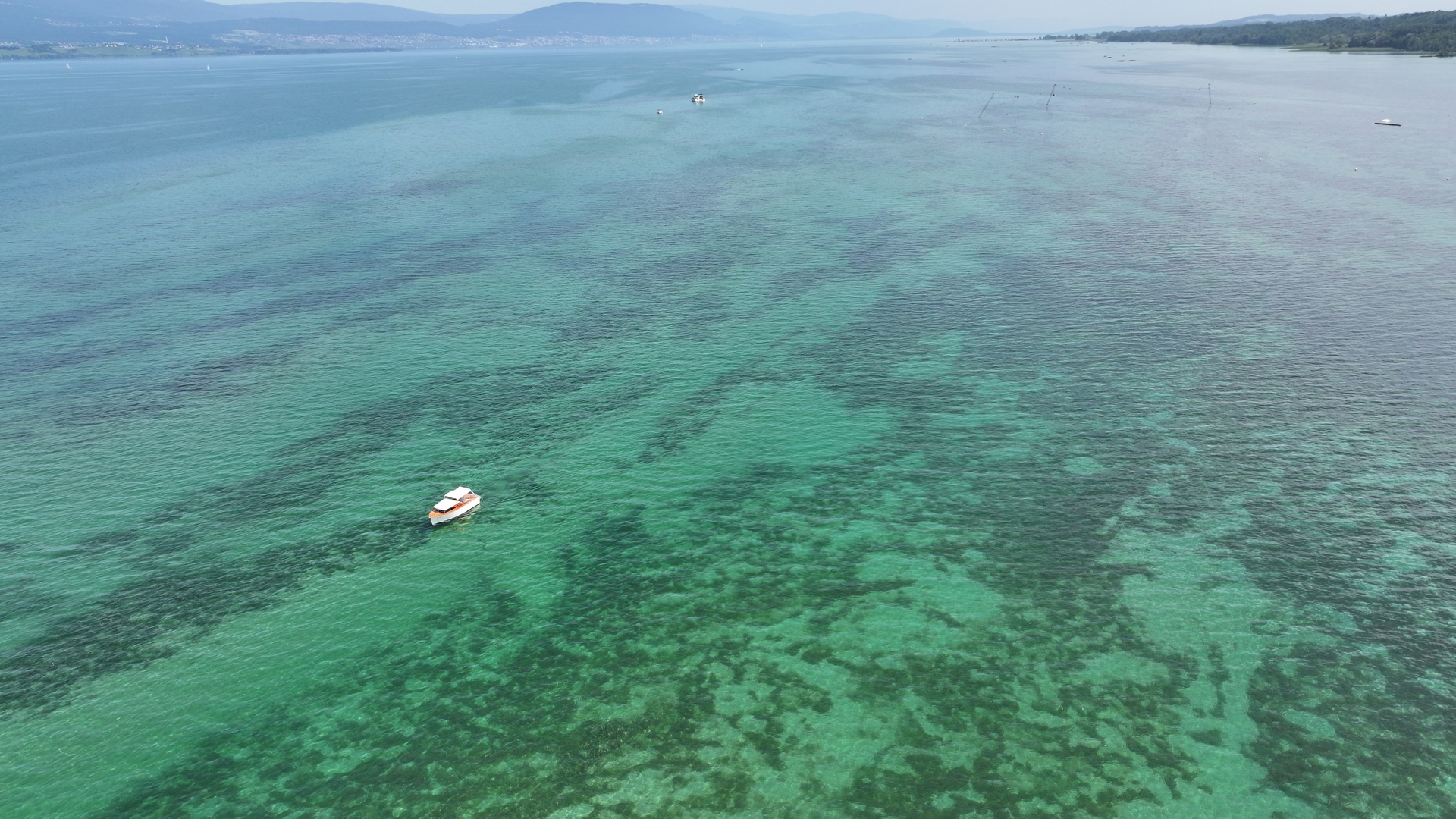
Alternating between marshy, lacustrine and terrestrial zones, the area is also well equipped for tourists, with wooden pontoons, an observation tower and a trail partly built on stilts. We continue our tour, resuming our cruising speed (around 20 knots) along the south shore, which is made up of sandy shoals giving rise to beautiful beaches, superb anchorage spots and no less than seven major marinas.
including Europe’s largest freshwater port, Chevroux, with some 1,100 berths.
As we stop to top up at Delley-Portalban (and estimate our consumption, as gauges from the 1970s can be unpredictable), my skipper for the day tells me that these marinas on the southern shores of the lake offer major boat-wellness facilities, with spaces ashore (up to 600 at Delley-Portalban), and cranes/travel lifts capable of lifting boats of up to 35 tonnes.
Further east, we approach the medieval town of Estavayer-le-lac, which dominates this southern shore. It immediately reminds me of Murten, which I saw that very morning. Indeed, the two towns have a similar layout. It makes you dream of medieval conflicts between the two cities. In fact, during the late Middle Ages, and particularly at the time of the Battle of Murten (1476), Estavayer-lelac was attached to the House of Savoy, while Murten was on the side of the Confederation. Despite some customary tensions, the two cities were never directly opposed militarily in their history.

Further east, we find Yverdon-les-Bains, the lake’s second-largest city with 30,000 inhabitants. The river Thielle flows through the town, and is navigable all the way to the town center. There is a large number of moorings on both sides of the river, right from the entrance. This suggests that if the breeze gets in, the first moorings will probably be quite exposed.
As you leave the Thielle and head towards Lake Neuchâtel, the area between Yverdon and Grandson is also a protected natural zone, the Vernes, with its numerous shoals. Although tempting, no-traffic signs tell us that it’s not possible to get close to the mouth of the Bey, which lies in the middle of this section.
So we headed for the Thielle canal on the opposite side of Lac de Neuchâtel, a distance of around 40 km (21 nm). This is an opportunity for Denis to remind me (while making a detour to Grandson to let me admire its castle) that Lac de “Neuch” is the largest lake in Switzerland since, unlike Lake Constance and Lake Geneva, it doesn’t share its shores with other countries.
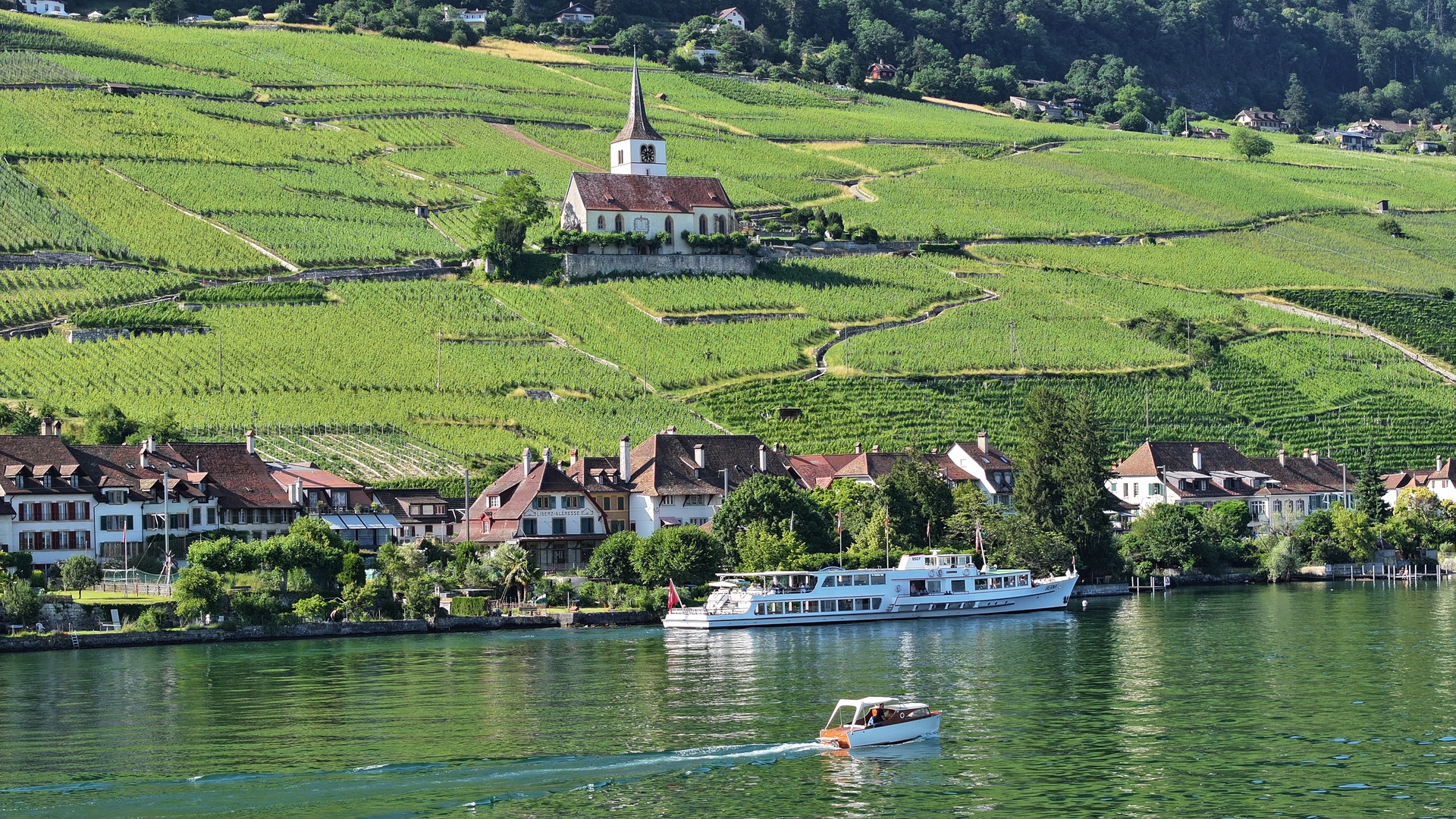
The north coast is totally different from the south, and with good reason: the Jura River flows directly into the lake, so villages and vineyards are on the hillside, and this becomes more pronounced as we advance towards the town of Neuchâtel. Ten deep-water ports dot this northern shore. Most are smaller than those on the south shore, but are more integrated into the towns.
The city of Neuchâtel has three ports. While the Old Port is mainly occupied by LMN’s passenger transport activities, the adjacent Jeunes-Rives harbour is entirely dedicated to yachting, with numerous visitor berths providing direct access to the city center. Before returning to the port du Nid-du-Crô, we walk along Jeunes-Rives. This area, which stretches for some 1,500 meters, is totally artificial. From the 1950s onwards, with the expansion of real estate projects, the city of Neuchâtel, entangled between the Jura mountains and the surrounding towns, struggled to expand. At the same time, various excavation projects, in particular those to bury the freeway
which began in 1976, created an enormous amount of rubble. This rubble was cleverly dumped on the lake to create this new area, which was to include a park, sports facilities and a site for the University of Neuchâtel… as well as a wastewater treatment plant. At the end of Jeunes-Rives, we discover the port of Nid-du-Crô. This consists of a covered, afloat technical complex at the end of which we find the fuel pump. It’s a good opportunity to see how little fuel we’re consuming, despite our frantic pace: around 10 l/hour. The joys of an old boat without too much equipment and therefore with a controlled weight estimate.

On our way out, we pass the surprising Palafitte Hotel, built on stilts for the 2002 Swiss National Exhibition. “With the helm hard to starboard, we set sail for the mouth of the Thielle canal, which will take us to Lake Biel. As soon as we enter the lake, the atmosphere is immediately more industrial. Once past the La Tène campsite, the landscape alternates between barges and barges moored to the pontoons of the cement works and other refineries lining the canal.
This doesn’t deter a group of pumping foilers who, only too happy to fly over our stern wave, accompany us for a good part of the 8.4 km (4.5 nm) canal. Here too, speed is limited to 8 knots, which we must be careful to respect, as a good number of pleasure boats are moored on either side, and radar controls are in place. At the end of the 34-minute transit, you’re on Lake Biel.

Enchanting landscapes and illustrious characters on Lake Biel
To starboard, on the south shore of the lake, we see Île Saint-Pierre. My private guide and skipper tells me that traces of life have been found here since Roman times. A Cluniac priory and convent were later established here between the 13th and 13th centuries.
Much later, in the Age of Enlightenment, Jean-Jacques Rousseau came to stay. Rousseau had fond memories of his brief stay here, where he was able to live in communion with nature. It was from this stopover that he drew the inspiration for his (unfinished) work Les Rêveries du promeneur solitaire. The bailiff of Nidau put an end to this reverie by banishing him from the island for life, just six weeks after his arrival.
Leaving the pontoon of the Hotel St Petersinsel, we set a north-easterly course for Biel. From one end to the other, the lake is 15 km long (8 nm), the northern shore steeper than Lake Neuchâtel and much less urbanized. Forests, vineyards and small villages blend harmoniously.
At the end of this warm day, a light breeze has sprung up, much to the delight of the local wine-loving population. The beach-goers were also out and about when we arrived in Biel. We had to make our way between paddles and bathers, sometimes difficult to make out in the low-lying late afternoon light.
We’re already at the mouth of the Nidau canal, which we follow (always accompanied by a swarm of pumping foil like seagulls flying behind a trawler). We now find ourselves opposite the harbour lock, which operates from 7 a.m. to 7.30 p.m. during the summer. A few moorings are provided to wait for the lock to open. Beyond the lock lies some 30 km of navigation on the Aare as far as the town of Solothurn. The currents here (which are in the direction of travel from Biel) are much stronger than in the canals.
It’s time to turn back. The modest size of our boat allows us to take the old Thielle through the southern residential districts of Biel, mingling with the people swimming, jumping off bridges and paddle-boarding on this fine early summer evening.
Heading back to our starting point, it’s time for a debriefing: in one day’s navigation, we’ve passed through four cantons: Vaud, Fribourg, Neuchâtel and Berne, and could have reached Solothurn by continuing past the lock. We covered around 100 nautical miles (185 km), passed through French-speaking and German-speaking territories, and burned less than 100 liters of unleaded in 10 hours of navigation, a very respectable 10 l/hour. Not bad for a fifty-year-old machine!